0
0
The Transpolar Mainline. The Russian Geographical Society is conducting research in Yamal and in Krasnoyarsk Krai
The first stage of the second field season of the Geographical expedition “The Transpolar Mainline” organized by the Russian Geographical Society was completed. It took place on the territory of Yamal-Nenets Autonomous Okrug and Krasnoyarsk Krai. The participants of the expedition continued the research, the results of which will form the grounds to define if it is expedient to build new railroad lines on the territory of Yamal-Nenets Autonomous Okrug and Krasnoyarsk Krai.
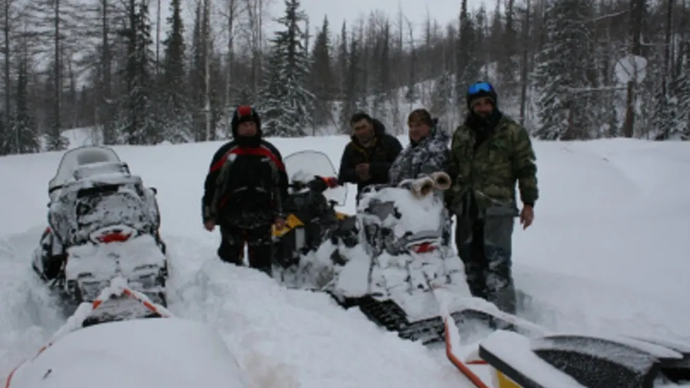
This spring the expedition group of the Russian Geographical Society, including representatives of the Russian University of Transport and the Military Topographical Directorate of the General Staff of the Armed Forces of the Russian Federation, conducted work on the area of possible passage of a promising railroad line from the existing Korotchayevo station to Norilsk industrial district. The participants of the expedition traveled 3800 kilometers, and about 3 thousand of them - on snowmobiles, as it is informed on the website of the Russian Geographical Society. Their path was laid on rare winter roads only in some places, and mostly - on snowy virgin land, on ice of the rivers Turukhan and Yenisei, on mountains located between Snezhnogorsk and Norilsk. The temperature along the route ranged from 30C degrees below zero to 5C degrees above zero, several times the group was caught in a serious snowstorm. Despite all the difficulties of the route, the researchers successfully coped with the set task.
On 19 control points of promising lines of the route the researchers took readings from metering devices on geothermic monitoring posts installed last autumn during the first field season of the expedition. In addition, the participants of the project installed two new geothermic monitoring posts - on the southernmost point of the area under study near the settlement Krasnoselkoup and on its northernmost point - near the town Dudinka. Now scientists will have more data about the area under study. The participants of the expedition also selected soil samples for laboratory study.
“The area of the expedition can be imagined as a huge triangle with peaks in Urengoy, Turukhansk and Norilsk”, said Sergey Chechulin, the head of the department for expedition activity of the Executive Directorate of the Russian Geographical Society. – “The shortest southern side of the triangle makes at least 500 kilometers long. The Polar Circle goes approximately in the middle of the triangle, but there are almost no roads inside it, only winter roads that connect oil and gas fields in the cold season. In order to fully study potential and features of building of a railroad line on the territory, the specialists of the Russian Geographical Society installed geothermic monitoring posts in various areas of the territory, which are sometimes extremely difficult to access”.
Construction of the railroad line on the section “Korotchayevo - Igarka - Norilsk” was started in 1949. According to the plan, the railroad track was to cross the rivers Pur, Taz, Turukhan and Yenisei, to climb north to Igarka and from there to Norilsk. Creation of the transport corridor was intended to facilitate development of northern territories rich in minerals. Construction of the route was fulfilled by convicts under the leadership of the Main Directorate of camps of the railway construction of the USSR and the section was called “Construction No. 503”. After the death of Joseph Stalin in 1953 construction was stopped, and the built railway sections were abandoned.
The photos by the participants of the expedition can be found here: https://sever-press.ru/2020/04/20/transpoljarnaja-magistral-rgo-provodit-issledovanija-na-jamale-i-v-krasnojarskom-krae/
0
0
Теги: